CCTV News: According to China Weather Network, on January 5, we ushered in the Little Cold solar term among the twenty-four solar terms, which represents the coldest period of the year. However, this year's Xiaohan started a bit warm. Starting tomorrow, a new cold air will gradually affect central and eastern my country, breaking the pattern of warmer temperatures. What else should I pay attention to next week’s weather?
Cold air is ready to go, and the weather is in a major turning point.
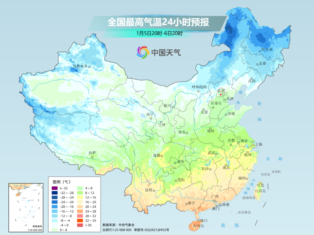
Recently, the temperature in most parts of the country is slightly higher than the same period in the previous year. Today, in Xiaohan, the warmer level in many places has even reached the recent high. However, a new cold air is ready to go, and its arrival will change the weather and warm pattern.
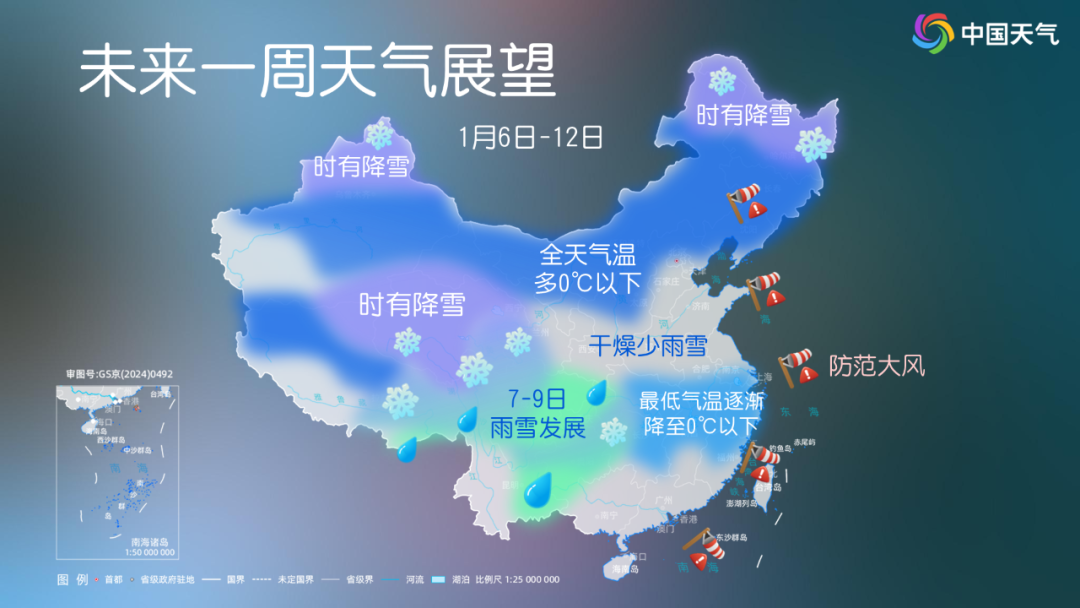
The Central Meteorological Observatory predicts that from the night of the 6th to the 9th, the southwest and most of the central and eastern regions will have a local cooling of 4 to 6 degrees Celsius, the northeast, Jianghan, western Jiangnan, Guizhou and other places will have a local cooling of more than 8 degrees Celsius, and the central and eastern Inner Mongolia, northern North China, and southern Northeast China.
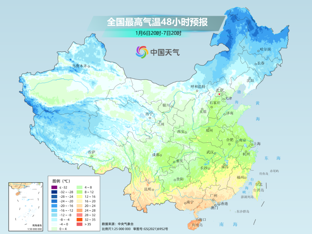
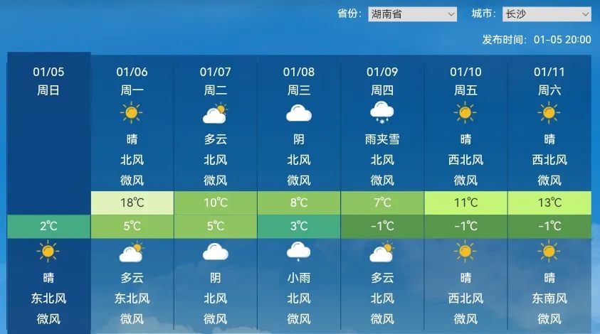
Especially from the Huanghuai to Jiangnan, the temperature fluctuations are the most obvious. Today, the highest temperature in most of the above-mentioned areas is still around 15℃, but after the cooling, it is expected that the temperature in the above-mentioned areas will fall to the bottom on the 9th, generally less than 5℃. Like Changsha, the highest temperature in tomorrow will continue to rise to 18℃, which is nearly 10℃ higher than the same period in the previous year; on the 9th, the highest temperature in Changsha will fall to 7℃, with a cumulative decline of 11℃.
In other cities, Nanjing, Shanghai and Hefei will experience cross-seasonal cooling. On the 9th, the coldest day after the beginning of winter will be spent and the chill that should be felt during the 39th season. Everyone should pay close attention to temperature changes and add clothes to keep warm in time.
There will be more rainy and snow in the southwest, Jiangnan and other places
In addition to cold air, precipitation in the Qinghai-Tibet Plateau and the southwest region will also develop from west to east next week, and some places may also usher in the first snow this winter.
At the day after tomorrow, due to the eastward movement of the southern branch trough, precipitation in the southwest region has developed rapidly and gradually expanded eastward to the western part of the south of the Yangtze River. Some areas may see rain and snow conversion.
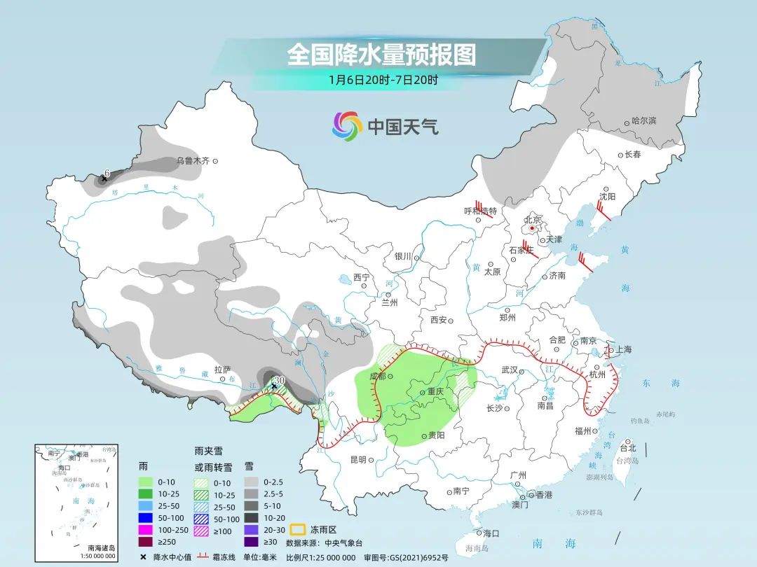
The Central Meteorological Observatory predicts that from the night of the 6th to the 9th, there will be light rain turning into sleet or snow in southern Sichuan, northern Yunnan, central and northern Guizhou, eastern Guizhou, western Hubei, and western Hunan. Among them, there will be moderate to heavy snow in some areas of southern Sichuan, northwestern and northeastern Yunnan, northern Guizhou, southwestern Hubei, and northwestern Hunan. The phases of rain and snow are relatively complex, and the strongest rain and snow period will occur on the 8th.
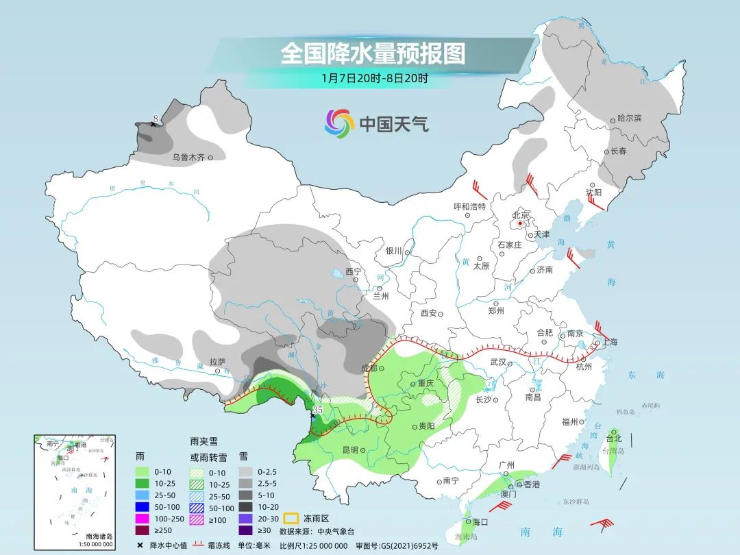
Southern friends who are looking forward to snowing must pay attention to the daily weather forecast recently. Maybe you will encounter the first snow this winter!