CCTV News: On January 18, the comprehensive service platform of my country's low-altitude scenarios - Star Map Low-altitude Cloud was officially released, providing support for the refined airspace management and safe flight service guarantee of low-altitude aircraft.


Star map low-altitude cloud is a comprehensive service platform in low-altitude scenarios built based on digital earth circle data and space-based satellite data supply capabilities, and is supported by supercomputers.

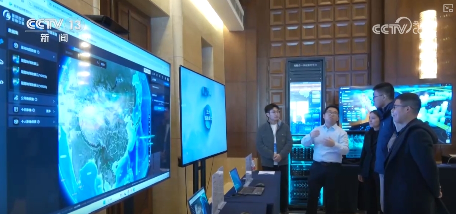
Shao Zongyou, deputy director of the National Engineering Research Center for Remote Sensing Satellite Application, introduced that low-altitude clouds are essentially intended to use the capabilities of satellites and the computing power of supercomputers to solve the problem of airspace grid management, route planning, safety assessment, flight support, and supercomputers to control it. This allows us to manage the flight of millions of drones in the sky at the same time. At the same time, the flight safety of hundreds of thousands of drones can be evaluated, and the settings of tens of thousands of flight routes can be planned. This greatly enhances the scale of airspace accommodation and flight safety.

According to reports, space-based satellite constellations such as electromagnetic constellations, meteorological constellations, remote sensing surveying and mapping constellations are also being laid out and constructed. The low-altitude cloud open platform based on aerospace information will be expected to provide comprehensive solutions for government low-altitude regulatory departments in airspace management, flight control, and enterprise services.