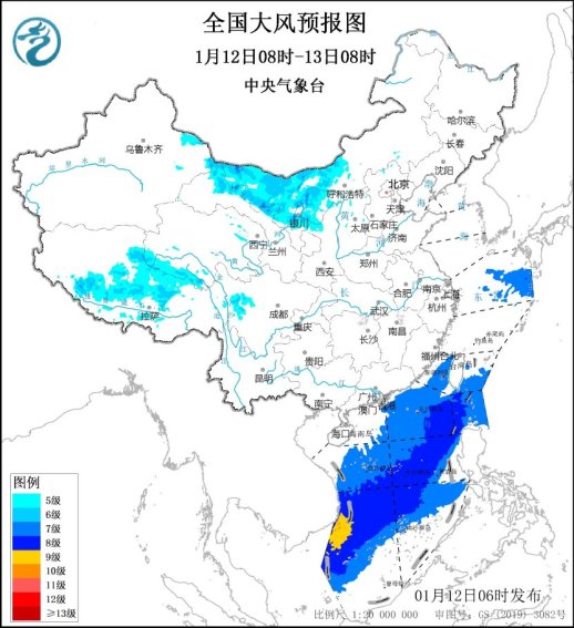
CCTV News: According to the website of the Central Meteorological Observatory, meteorological monitoring shows that strong winds and dust occurred in the eastern part of the northwest region and Inner Mongolia yesterday. It is expected that today, some of the above-mentioned areas will still have strong winds due to cold air, accompanied by sand or dust weather. Starting from the 13th, strong cold air will be launched in the central and eastern regions. The temperature in most areas will drop by 4 to 6℃, and some areas will drop by more than 8℃. There will be 4 to 6 winds in central and eastern Inner Mongolia, Northeastern region, northern North China and other places, with gusts of 7 to 8; there will be 7 to 8 winds in the eastern and southern waters, with gusts of 9 to 10.
The Central Meteorological Observatory continued to issue a blue warning for strong winds this morning. It is expected that today, there will be strong winds of 5 to 6 in western Inner Mongolia, northwestern Gansu, northern Ningxia, northwestern Shaanxi, central and eastern Tibet, southern Qinghai, western Sichuan Plateau and other areas, with gusts of 7 to 8; there will be strong winds of 7 to 8 in the northeastern East China Sea, the eastern seas of Taiwan Strait, the southeastern ocean surface of Taiwan, the Bashi Strait, and most of the South China Sea. Among them, the winds of some seas in the southwestern South China Sea can reach 9 and gusts of 10. Meteorological experts remind that if there are strong winds in the northern region in the near future, the public should pay attention to the latest forecast and warning information in a timely manner, beware of falling objects from high altitudes when going out, and take measures to prevent cold and keep warm when outdoor activities.
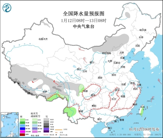
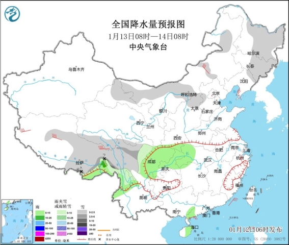
In terms of precipitation, it is expected that from the 12th to the 13th, snowfall will mainly be concentrated in southern and eastern Tibet, western Sichuan Plateau and other places. Some of the above areas will have light to moderate snow from west to east. Among them, there will be heavy snow or blizzards in eastern Tibet on the 13th. Most of Tibet has a cooling rate of 4 to 6℃, and local cooling rate of more than 8℃.
Meteorological experts remind that since this year, most areas of central and eastern my country have had less precipitation or no precipitation, and it is expected that precipitation will remain relatively low in the next ten days. In the next three days, the forest fire risk level will be high in some areas in eastern Jiangnan, southern China, and other places. The weather will be high and the weather will be dry. The public needs to raise their safety awareness and pay attention to forest fire prevention and home fire safety.